Earth Science Is Not Just a Class — It Explains Everything Around You. Here is a thought that might stop you mid-scroll: the ground beneath your feet is moving right now. Not enough to feel, but enough to matter. The tectonic plate you are standing on shifts a few centimeters every year — roughly the same speed your fingernails grow. That single fact connects geology, physics, biology, and climate science in one image.
That is what makes earth science different from any other subject. It is not abstract. It is the planet you live on. Every earthquake, every thunderstorm, every canyon carved into red rock and every coral reef bleaching under warming oceans — all of it falls under the umbrella of earth science.
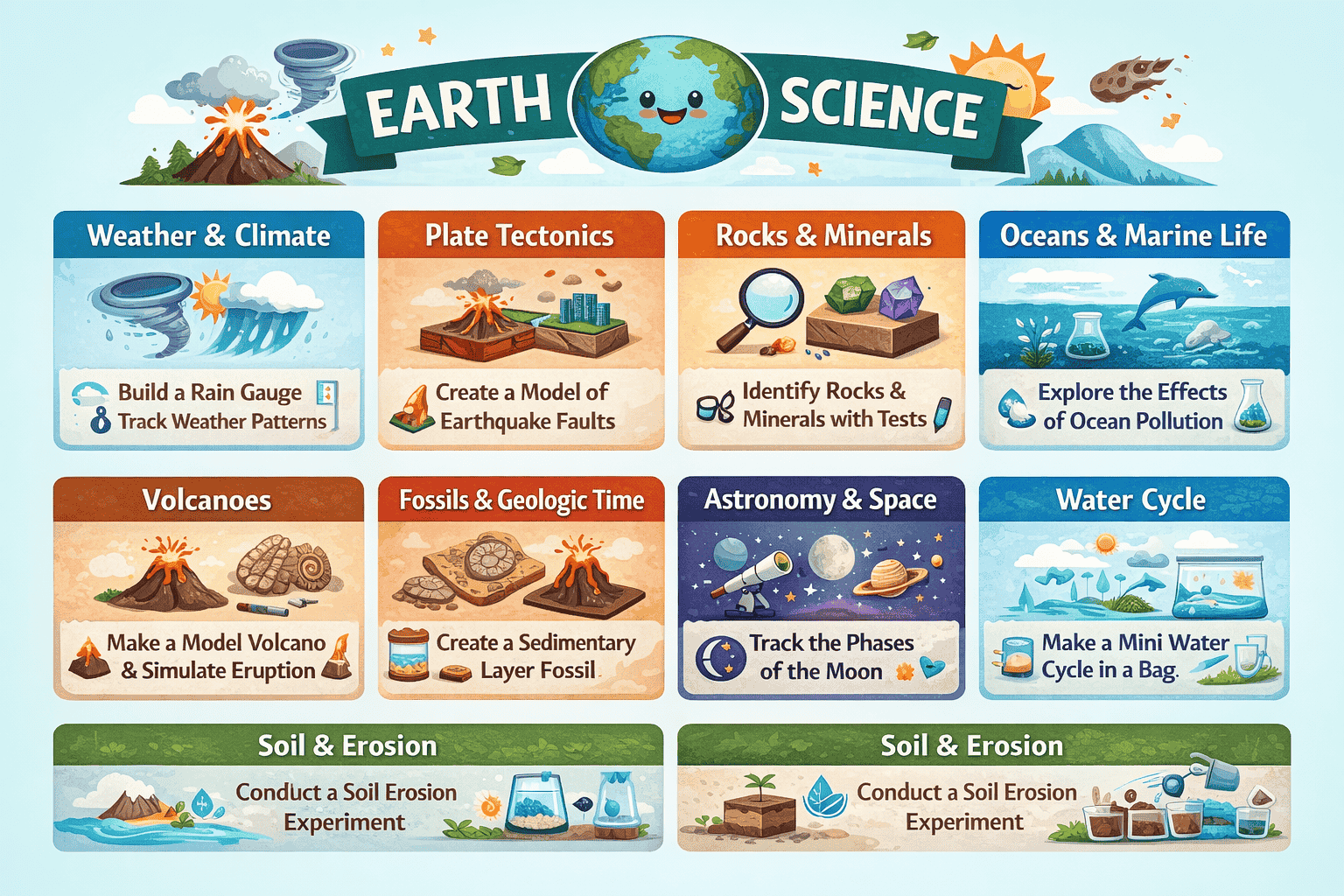
This guide covers the most interesting earth science topics for middle and high school students, organized by branch of study. Each topic includes what makes it genuinely fascinating, what it connects to in the real world, and a hands-on project idea you can do with everyday materials, in a classroom, at home, or as a science fair entry.
Whether you are a student looking for a research topic, a teacher planning a unit, or simply someone who wants to understand how this planet actually works — you are in the right place.
What Is Earth Science, and What Does It Actually Cover?
Earth science — also called geoscience — is the study of everything about planet Earth: its solid body, its oceans, its atmosphere, and its place in space. Scientists divide it into four broad branches:
Geology studies the solid Earth — rocks, minerals, soil, landforms, and the internal forces that shape them over millions of years.
Meteorology and climatology study the atmosphere — weather patterns, storm systems, climate zones, and how human activity is shifting the global climate.
Oceanography studies Earth’s oceans — their chemistry, currents, ecosystems, and role in regulating temperature worldwide.
Astronomy (in the earth science context) examines Earth’s relationship with space — how the Sun drives our seasons, how the Moon creates tides, and how cosmic events have shaped life on this planet.
Each of these branches contains dozens of sub-disciplines — seismology, volcanology, glaciology, hydrology, paleoclimatology, geomorphology, and more. The topics below draw from all of them, selected because they are genuinely interesting, curriculum-relevant under NGSS (Next Generation Science Standards), and rich with possibilities for student investigation.
10 Fascinating Earth Science Topics With Project Ideas
1. Plate Tectonics — The Engine That Rebuilds the World
What it is: Plate tectonics is the theory that Earth’s outer shell, the lithosphere, is broken into large slabs called tectonic plates that move slowly across the surface. These plates carry the continents and ocean floors, and their movement drives some of the most dramatic processes on Earth: mountain formation, earthquakes, ocean trenches, and volcanic eruptions.
Why it is fascinating: About 200 million years ago, all of Earth’s continents were joined in one giant landmass called Pangaea. The continents we recognize today drifted into their current positions over millions of years — and they are still moving. The Atlantic Ocean widens by about 2.5 centimeters every year. India is still crashing into Asia, which is why the Himalayas keep growing taller. The ocean floor at the Mariana Trench is being pulled downward into the mantle in a process called subduction, where it melts and feeds the volcanic Ring of Fire circling the Pacific Ocean.
Real-world connection: Understanding plate tectonics explains where earthquakes and volcanoes happen and why — critical knowledge for building safer cities and preparing communities in high-risk zones.
Project idea — The Convection Current Model: Mantle convection is what drives plate movement. Fill a clear baking dish with water. Place it on a hot plate or stove burner and add a few drops of food coloring to the center bottom. Watch how the colored water circulates: heated water rises in the center, spreads outward, cools, and sinks at the edges. This simple model demonstrates the same process that causes tectonic plates to drift. For a more advanced version, measure the temperature at multiple points in the water and map the convection cell. Then write a brief explanation connecting what you observed to the real movement of Earth’s crust.
Grade level: Middle school (introductory) and high school (advanced models, data analysis)
2. The Rock Cycle — Three Types of Rock in Constant Transformation
What it is: The rock cycle describes the continuous process by which rock changes from one form to another over time. Igneous rocks form when magma or lava cools. Sedimentary rocks form when particles of material accumulate in layers and compress over millions of years. Metamorphic rocks form when existing rocks are transformed by intense heat and pressure. None of these forms is permanent — each can become another type under the right conditions.
Why it is fascinating: The granite countertop in a kitchen started as magma deep inside the Earth. The limestone in ancient buildings formed from the compressed shells of sea creatures that lived 300 million years ago. The quartzite in a mountain trail began as beach sand before heat and pressure remade it entirely. The rock cycle is a record of Earth’s entire history written in stone — literally.
Real-world connection: Petroleum and natural gas form in sedimentary rock layers. Diamonds form from carbon subjected to extreme metamorphic pressure. Understanding the rock cycle helps geologists locate valuable mineral deposits and assess soil quality for agriculture and construction.
Project idea — Crayon Rock Cycle Model: Use crayons as a surprisingly accurate model of rock transformation. Start with crayon shavings representing sediment. Press them together using your palm or a folded piece of foil to model how pressure creates sedimentary rock. Then fold the compressed shavings into foil and press harder — or apply gentle heat with warm (not boiling) water in a sealed plastic bag — to create a “metamorphic” version. Finally, fully melt the crayon pieces in a foil cup using warm water or a hair dryer to simulate magma, then let them cool into an “igneous” form. Compare all three stages. This tactile project makes abstract geological processes visible and memorable.
Grade level: Middle school (all stages), high school (add mineral identification and geological cross-section mapping)
3. Earthquakes and Seismology — Reading the Shocks That Reshape the Earth
What it is: Seismology is the study of earthquakes and the seismic waves they produce. Earthquakes occur when stress builds along a fault line — a fracture in Earth’s crust — and releases suddenly, sending waves of energy radiating outward through the ground. Seismologists use instruments called seismometers to detect and measure these waves, determine the magnitude and location of earthquakes, and study Earth’s internal structure.
Why it is fascinating: In March 2025, a 7.7-magnitude earthquake struck Myanmar — and for the first time in history, a nearby CCTV camera captured the actual fault rupture happening at the surface in real time. Scientists also use seismic waves to “see” inside Earth the same way doctors use ultrasound — by tracking how waves travel through different materials at different speeds. The discovery that Earth has a liquid outer core and solid inner core came entirely from analyzing seismic wave behavior.
Real-world connection: Seismic monitoring networks protect millions of people by providing early warning systems. Japan’s earthquake early warning system can send alerts seconds before shaking arrives — enough time for people to drop, cover, and hold on, or for automated systems to slow down trains.
Project idea — Earthquake Magnitude vs. Building Height: Build three small towers using index cards, tape, and paper clips — one short, one medium, one tall. Place them on a flat tray lined with sand. Shake the tray at different intensities (simulating low, moderate, and high-magnitude earthquakes). Record which structures topple first and at what intensity. Then add crumpled paper “base isolators” under each structure to simulate earthquake-resistant engineering and repeat. Document your results in a data table and write up a conclusion connecting building height, foundation design, and seismic survival. This connects earth science directly to engineering and urban planning.
Grade level: Middle school (model building, observation), high school (add Richter scale analysis, logarithmic scale math, and engineering design criteria)
4. Volcanoes and Volcanology — The Planet’s Pressure Release Valves
What it is: Volcanology is the study of volcanoes, magma, and the geological processes that produce them. Volcanoes form where magma — molten rock from Earth’s mantle — reaches the surface through cracks or vents. They appear above subduction zones, at mid-ocean ridges, and above hotspots like the one beneath Hawaii.
Why it is fascinating: Hawaii’s Mauna Kea is technically taller than Mount Everest — most of it just sits underwater. The world’s longest mountain range, the mid-ocean ridge, stretches 65,000 kilometers across the ocean floor and is almost entirely volcanic. And research published in July 2025 revealed that melting glaciers could reactivate dormant subglacoes volcanoes — particularly in Antarctica — because the weight of ice that has suppressed eruptions for thousands of years is disappearing, potentially triggering new volcanic activity as the pressure lifts.
Real-world connection: Volcanic eruptions release aerosols into the stratosphere that can temporarily cool global temperatures. The 1991 eruption of Mount Pinatubo lowered global average temperatures by about 0.5°C for nearly two years. Volcanologists study eruption patterns to improve forecasting and protect communities in active volcanic zones.
Project idea — The pH Difference Between Lava Types: Not all lava is the same. Basaltic lava (runny, low silica) produces the gentle flows seen in Hawaii. Rhyolitic lava (thick, high silica) produces explosive eruptions. Demonstrate this difference using two “lavas”: one made of runny baking soda-and-vinegar reaction in a flat container (simulating low-viscosity flow) and another using thick cornstarch-and-water mixture with added vinegar (simulating higher-viscosity explosive behavior). Measure how far each “lava” flows in 30 seconds. Then test how different slopes affect the flow distance. This project demonstrates the physics of viscosity in a memorable, visual way.
Grade level: Middle school (observation and measurement), high school (add silica content analysis, explosive index data, and comparison of real volcanic events)
5. The Water Cycle and Hydrology — How Every Drop of Water Travels the Planet
What it is: Hydrology is the science of water — its movement, distribution, and quality across Earth’s surface and underground. The water cycle describes how water evaporates from oceans and land, rises into the atmosphere, condenses into clouds, falls as precipitation, flows across land as runoff, soaks into the ground as groundwater, and eventually returns to the ocean to begin again.
Why it is fascinating: The water in your glass right now has been cycling through Earth’s systems for billions of years. It has been inside ancient oceans, locked in glaciers during ice ages, absorbed by dinosaurs, and fallen as rain over prehistoric forests. Groundwater stored in aquifers — massive underground reservoirs — took thousands of years to accumulate, but humans pump it out far faster than it naturally recharges. In some parts of the American West, aquifers are depleting at rates that could make agriculture impossible within generations.
Real-world connection: Hydrologists study flood risk, drought prediction, groundwater contamination, and water supply management. As climate change alters precipitation patterns, hydrology becomes one of the most urgently important sciences of this century.
Project idea — Transpiration Rate and Deforestation: Plants release water vapor through their leaves in a process called transpiration, which contributes meaningfully to local humidity and rainfall patterns. Test this directly: seal a plastic bag around a leafy branch or a potted plant in sunlight. After two hours, measure the water droplets that accumulate inside the bag. Repeat with a bare branch and compare. Then research how deforestation in the Amazon affects regional rainfall — deforested areas receive significantly less precipitation because transpiration from trees drives much of the water cycle in tropical regions. Connect your experiment to this larger pattern in a written or visual report.
Grade level: Middle school (basic observation), high school (quantitative measurement, comparison across plant types, connection to deforestation data)
6. Ocean Acidification — The Quiet Chemical Transformation of the World’s Oceans
What it is: Ocean acidification is the ongoing decrease in the pH of Earth’s oceans, caused by the absorption of carbon dioxide from the atmosphere. When CO₂ dissolves in seawater, it forms carbonic acid, which lowers the ocean’s pH. Since the Industrial Revolution, ocean pH has dropped from about 8.2 to 8.1 — a shift that sounds small but represents roughly a 26% increase in acidity due to the logarithmic nature of the pH scale.
Why it is fascinating: This change threatens organisms that build shells and skeletons from calcium carbonate — including oysters, clams, sea urchins, and coral. When seawater becomes more acidic, carbonate ions become less available, making it harder for these creatures to build and maintain their structures. Coral reefs support roughly 25% of all marine species despite covering less than 1% of the ocean floor — making acidification one of the most serious ecological challenges on the planet.
Real-world connection: Ocean acidification affects seafood industries worth billions of dollars worldwide, threatens coastal fisheries that millions of people depend on for food and income, and risks the collapse of reef ecosystems that protect coastlines from storm surge.
Project idea — Shell Dissolution Experiment: Collect several empty snail shells or eggshells (both are made of calcium carbonate, the same material as coral skeletons). Weigh each shell on a kitchen scale. Submerge one set in plain water, one set in vinegar (a mild acid simulating acidified seawater), and one set in water with added baking soda (a slightly more basic solution). After 24 hours and again after 48 hours, remove the shells, rinse them gently, let them dry, and reweigh. Record mass loss over time and photograph the surface changes. Graph your results. Write a conclusion that explains what your data predicts for marine organisms in increasingly acidic oceans.
Grade level: Middle school (qualitative observation), high school (quantitative mass loss data, pH measurement, comparison to published ocean acidification rates)
7. Climate Science and the Greenhouse Effect — Understanding the Atmosphere as a Blanket
What it is: Climate science studies Earth’s long-term atmospheric patterns and the forces that change them. The greenhouse effect refers to the process by which certain gases in the atmosphere — carbon dioxide, methane, water vapor, and nitrous oxide — absorb outgoing infrared radiation from Earth’s surface and re-radiate it back downward, warming the planet. Without any greenhouse effect, Earth’s average surface temperature would be approximately −18°C instead of the current +15°C. With too much, temperatures rise beyond the range that supports current ecosystems and human civilization.
Why it is fascinating: Ice cores drilled from Antarctica contain air bubbles trapped hundreds of thousands of years ago — and scientists can measure the exact concentration of greenhouse gases in those ancient samples. This data confirms that current atmospheric CO₂ levels are higher than at any point in the past 800,000 years. Climate science connects geology, chemistry, physics, biology, and economics in ways no other discipline does.
Real-world connection: Understanding feedback loops in the climate system — such as how melting permafrost releases methane, which accelerates warming, which melts more permafrost — is essential for predicting and preparing for future conditions.
Project idea — DIY Greenhouse Gas Comparison: Set up two identical clear plastic bottles or glass jars with thermometers inserted through sealed lids. Fill one bottle with plain air. Into the second bottle, release a small amount of CO₂ by mixing baking soda and vinegar inside a separate container and gently blowing the gas into the bottle before sealing. Place both bottles under a bright lamp or in direct sunlight. Record the temperature in both bottles every five minutes for 30 minutes. The CO₂-enriched bottle should warm more quickly. Plot your temperature data on a line graph and explain the mechanism behind the difference.
Grade level: Middle school (basic temperature comparison), high school (add feedback loop analysis, atmospheric gas concentration data from NASA or NOAA, and policy discussion)
8. Glaciology — Reading Climate History in Layers of Ice
What it is: Glaciology is the study of ice in all its forms — glaciers, ice sheets, sea ice, and permafrost. Glaciers form where snow accumulates faster than it melts over many years, compressing into dense ice that flows slowly under its own weight. Ice sheets cover Antarctica and Greenland and contain roughly 69% of Earth’s fresh water.
Why it is fascinating: Antarctic and Greenland ice sheets contain a layered record of Earth’s entire climate history stretching back 800,000 years. Each annual layer of ice traps air bubbles, dust, volcanic ash, and chemical signatures that tell scientists what the atmosphere, temperature, and even solar activity looked like at that exact point in time. In 2025, research confirmed that stable sea ice along Alaska’s coast is disappearing faster than expected — forming weeks later in autumn and breaking away weeks earlier in spring. If both the Antarctic and Greenland ice sheets melted entirely, sea levels would rise by over 65 meters globally.
Real-world connection: Glacier retreat affects freshwater supplies for hundreds of millions of people in Asia and South America who depend on glacier-fed rivers. It also affects global sea level, coastal flooding risk, and ocean circulation patterns.
Project idea — Ice Core Proxy Data Simulation: Create a visual “ice core” model using a clear plastic tube, layered with different colored sand or soil representing different time periods. Use color to represent events: a layer of dark ash for a volcanic eruption, a white layer for high-snowfall years, a thin layer for drought years. Present the model alongside a timeline and explain what each layer reveals. For a more advanced version, find a publicly available Antarctic ice core dataset from NOAA’s National Centers for Environmental Information, plot the CO₂ concentration data against estimated temperature anomalies, and analyze the correlation.
Grade level: Middle school (model construction and timeline), high school (data analysis, graphing, ice core interpretation)
9. Soil Science — The Living Skin of the Planet
What it is: Soil science — also called pedology — is the study of soil as a natural resource: its formation, classification, properties, and role in ecosystems. Soil is not simply dirt. It is a complex mixture of mineral particles, organic matter, water, air, and billions of living microorganisms per teaspoon — bacteria, fungi, protozoa, nematodes, and more.
Why it is fascinating: It takes approximately 500 years for natural processes to produce just one inch of productive topsoil. Yet humans lose an estimated 24 billion tons of fertile topsoil every year to erosion caused by poor agricultural practices, deforestation, and construction. The soil beneath a healthy forest floor acts as a carbon sink, storing more carbon than the trees themselves. Destroy the soil, and you release that carbon into the atmosphere.
Real-world connection: Soil degradation threatens global food security. About 95% of the world’s food is produced on land, and healthy soil is the foundation of every agricultural system. Restoring degraded soils through techniques like cover cropping, composting, and no-till farming is one of the most scalable climate change mitigation strategies available.
Project idea — Erosion Control Engineering Challenge: Fill three identical trays with the same amount of soil. Leave the first bare. Cover the second with a layer of grass clippings or moss. Plant fast-germinating seeds (like rye grass or radish) in the third two weeks before the experiment. Then tilt each tray at the same angle and pour the same measured amount of water slowly down the slope. Collect the runoff in containers. Measure how much soil each runoff contains by weighing the dried sediment. Photograph the surface of each tray. Conclude with an analysis of which land cover type protects soil best — and connect your findings to real agricultural practices used around the world.
Grade level: Middle school (observation and comparison), high school (quantitative sediment measurement, statistical comparison, policy connections)
10. Meteorology — The Science of Every Storm, Cloud, and Breeze
What it is: Meteorology is the study of Earth’s atmosphere and the physical processes that produce weather. Meteorologists study air pressure, temperature, humidity, wind patterns, and the formation and movement of weather systems — from everyday rain clouds to category 5 hurricanes.
Why it is fascinating: Tornadoes are still not fully understood. Scientists know they form from rotating thunderstorms called supercells, but predicting exactly which supercells will produce tornadoes — and when — remains one of meteorology’s unsolved challenges. Separately, the jet stream — a fast-flowing river of air in the upper atmosphere — shapes weather patterns across entire continents. Research suggests that a warming Arctic is slowing the jet stream, causing weather systems to linger longer in place, producing more extreme heat waves and prolonged cold snaps.
Real-world connection: Weather forecasting affects agriculture, aviation, shipping, emergency management, and everyday life. Advances in satellite technology and computational modeling now allow forecasters to predict weather patterns with greater accuracy up to 10 days in advance.
Project idea — Build a Working Barometer: A barometer measures air pressure, which is one of the primary indicators of incoming weather changes. Cut the neck off a balloon and stretch the remaining rubber tightly over the mouth of a glass jar or can. Tape a long, thin straw horizontally to the center of the stretched rubber, so it extends out over the edge. Tape a piece of cardboard vertically beside the straw’s tip and mark the straw’s current position. Check the barometer twice daily for two weeks. When air pressure rises (the rubber domes downward), the straw tip rises — indicating stable or improving weather. When pressure drops, the straw tip falls — indicating incoming storms or rain. Compare your barometer readings to actual weather outcomes each day. Calculate your prediction accuracy rate.
Grade level: Middle school (construction and observation), high school (data logging, accuracy calculation, comparison to official pressure data, atmospheric science connections)
A Topic Comparison Table: Which Earth Science Subject Fits Your Interest?
| Topic | Branch | Connects To | Best For |
|---|---|---|---|
| Plate tectonics | Geology | Physics, geography, engineering | Students who like big, visible forces |
| Rock cycle | Geology | Chemistry, mineralogy | Students who like collecting and classifying |
| Earthquakes / seismology | Geology | Physics, engineering, math | Students who like data and patterns |
| Volcanoes / volcanology | Geology + geochemistry | Chemistry, physics | Students who like dramatic processes |
| Water cycle / hydrology | Hydrology | Agriculture, policy, biology | Students who like systems thinking |
| Ocean acidification | Oceanography + chemistry | Biology, policy, economics | Students interested in environmental issues |
| Climate science | Climatology | Chemistry, physics, policy | Students who want to work on real-world problems |
| Glaciology | Cryosphere science | History, paleoclimatology, data | Students who like big-picture time scales |
| Soil science | Pedology + ecology | Agriculture, ecology, engineering | Students interested in food and land |
| Meteorology | Atmospheric science | Physics, math, technology | Students who like prediction and observation |
How to Turn Any Earth Science Topic Into a Strong Research Paper
Choosing a topic is only the first step. Here is a simple framework that works for any of the topics above:
Start with a question, not a statement. “Ocean acidification damages coral reefs” is a conclusion. “How does ocean pH change affect the shell strength of marine organisms?” is a research question — and a much stronger starting point for genuine investigation.
Connect to your local environment. The best science projects connect global processes to local evidence. 1. If you live near a river, study its sediment load. 2. If you live in an earthquake zone, map local fault lines. 3. If your region has experienced flooding, connect it to changing precipitation patterns. Local connections give your research specific, testable data.
Use publicly available data. NASA, NOAA, the USGS, and NSIDC (National Snow and Ice Data Center) all offer free datasets that students can download and analyze. Using real scientific data transforms a textbook exercise into genuine research.
Test something predictive. The strongest student projects don’t just describe — they predict. “Based on current CO₂ trends, what will ocean pH be in 2050, and how does my shell dissolution data support or complicate that prediction?” That kind of forward-looking question shows sophisticated scientific thinking.
Frequently Asked Questions
What earth science topic is best for a science fair? Ocean acidification, soil erosion, and the greenhouse effect all make excellent science fair topics because they involve testable, measurable variables using accessible materials. The key is a clear experimental question, a controlled variable, and quantitative data collection.
What is the most important earth science topic to understand? Plate tectonics is arguably the most foundational because it explains earthquakes, volcanoes, mountain formation, ocean basins, and the arrangement of continents. Once you understand that Earth’s surface is dynamic and constantly in motion, almost everything else in geology makes sense.
What is the difference between earth science and environmental science? Earth science focuses on natural Earth systems and processes — geology, meteorology, oceanography, and space. Environmental science specifically examines the relationship between humans and those systems — pollution, resource use, conservation, and the impact of human activity on the natural world. They overlap significantly, but earth science is broader in scope.
Are earth science topics relevant to everyday life? Absolutely. Weather forecasts, earthquake preparedness, water supply management, soil health for agriculture, and sea level planning for coastal cities all depend directly on earth science knowledge. Understanding how Earth’s systems work is not just academic — it is essential for making good decisions as a society.
What are the best earth science careers? Geoscience fields include seismologist, volcanologist, climatologist, hydrologist, oceanographer, environmental geologist, soil scientist, meteorologist, glaciologist, and geochemist. Many of these careers involve fieldwork, data analysis, laboratory research, and direct application to public safety and environmental policy.
Final Thoughts: Every Square Meter of This Planet Is a Topic Worth Studying
Earth science has a habit of making the ordinary extraordinary. A pebble on a hiking trail carries 400 million years of history. A thunderstorm is a heat engine redistributing solar energy. A melting glacier is both a climate archive and a warning. Soil is a living ecosystem more complex and less visible than a rainforest.
The topics in this guide are not just curriculum checkboxes. They are real phenomena that real scientists are actively studying, debating, and trying to understand more deeply. In 2025 alone, researchers discovered the oldest known rock formation on Earth (4.16 billion years old, in northern Quebec), mapped mysterious earthquakes deep inside the planet, and uncovered a thriving ecosystem nearly 6 miles below the ocean surface that survives without sunlight.
The planet is still full of unsolved problems. Some of the students reading this guide will spend their careers working on them.
The best place to start is exactly where you are: curious about one thing on the list above, and willing to ask a better question.